|
|
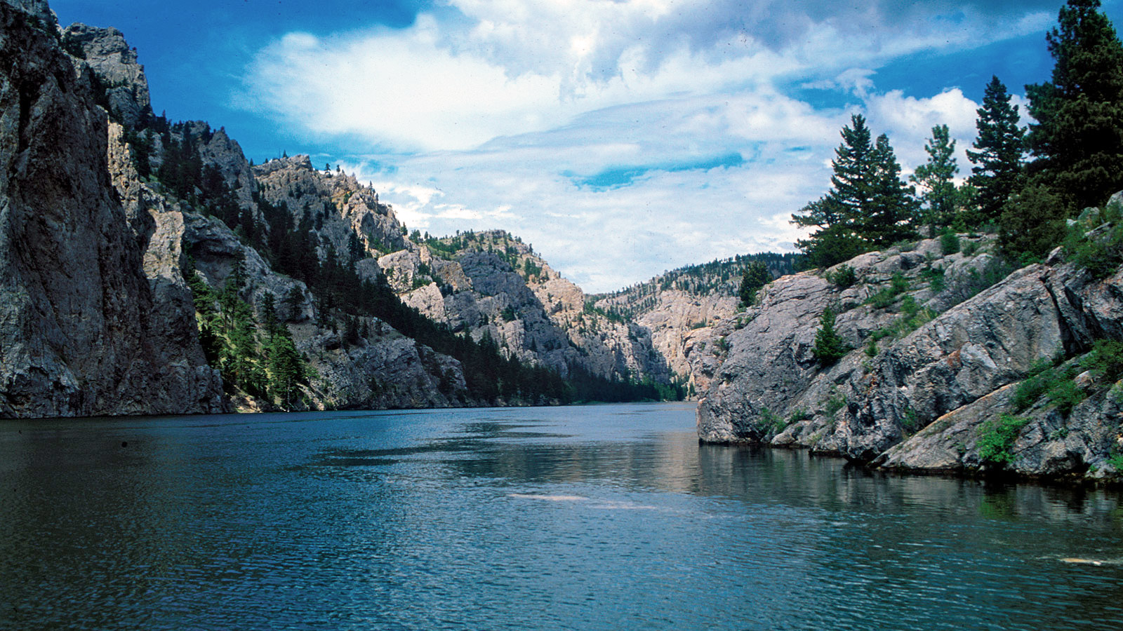
Fig. 1 The Missouri river.
THE TRUE SOURCE OF THE MISSOURI RIVER
Victor M. Ponce
200314
|
1. SOURCE OF A RIVER
The source of a large river system, for example, the Missouri
river, is often taken
as the location of the uppermost spring in the farthest tributary.
Under this optic, the source of the Missouri
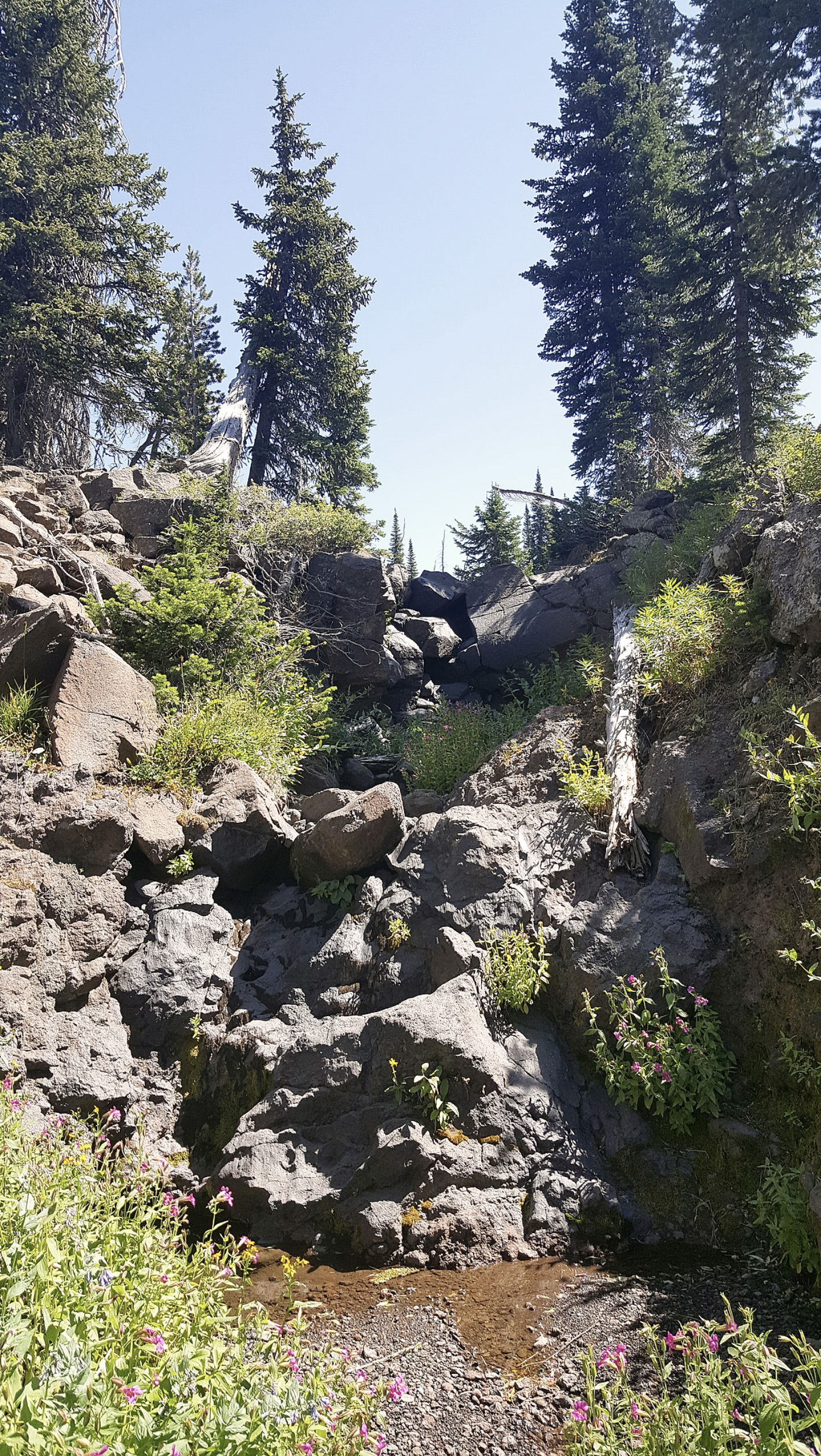
river would be Brower's Spring (Fig. 2), located in the headwaters of Hell Roaring Creek,
in southwestern Montana, near the border with Idaho (Fig. 3).
The spring is named after
Jacob V. Brower, who in 1896 declared it to be the source of the Missouri river
in his book
The Missouri river and its utmost source.
However, the name Brower's Spring
is not listed as an official name on the Geographic Names Information System maintained by the U.S.
Geological Survey.
| Aualliso (Wikimedia Commons) |
Fig. 2 Brower's Spring, in the
headwaters of Hell Roating Creek,
in southwestern Montana.
|
Panoramio (Google Earth ®) |
Fig. 3 Hell Roaring Creek, in southwestern Montana, the
most upstream tributary of the Missouri river.
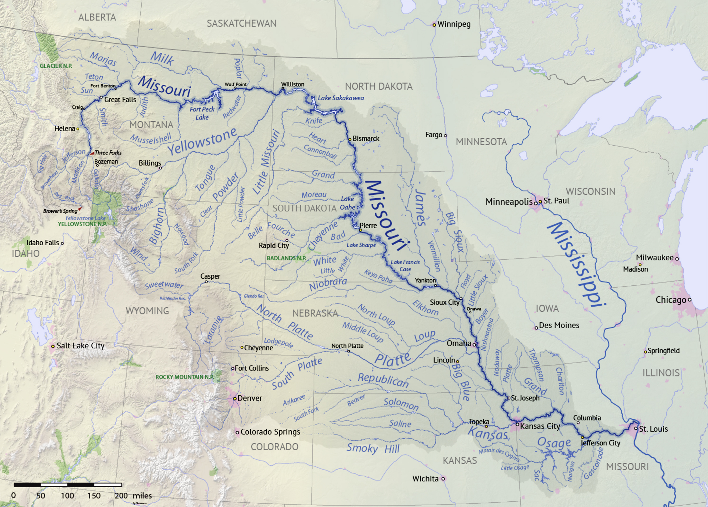
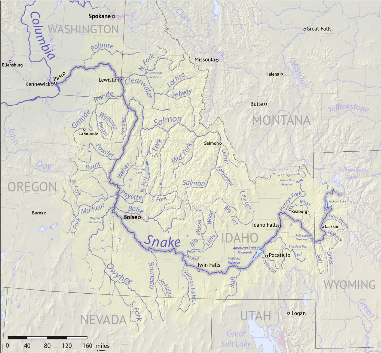
2. MISSOURI RIVER BASIN
The Missouri River is the longest river in North America.
With its source in the Rocky
Mountains of western Montana, the Missouri flows first north, then
east and south for 3,767 km (2,341 miles)
before joining the Mississippi River north of St. Louis, Missouri.
The river drains a sparsely populated, semiarid watershed of
1,370,000 square kilometers (529,200 square miles),
which comprises parts of ten U.S. states and two
Canadian provinces. Although nominally considered a tributary of the Mississippi,
the Missouri River is much longer and carries a comparable
volume of water. The combined Missouri-Mississippi
forms the world's fourth longest river system in the world.
The longest tributary of the Missouri river
begins a short distance upstream of Brower's Spring,
on the southeastern slopes of Mount Jefferson,
in the Centennial Mountains of the Bitterroot Range
(click on top of Fig. 4 to
see red arrow in the large display). From there it flows first
as Hell Roaring Creek, then west into Red Rock Creek;
then it swings northeast to become the Beaverhead River;
and finally it joins the Big Hole to form the Jefferson river.
The latter joins the Madison river to become the Missouri River at
Missouri Headwaters State Park near Three Forks, Montana (see actual
location in the large display of Fig. 4).
[Click on top of map to display]
Fig. 4 Missouri river basin, indicating the location of Brower's Spring, in southwestern Montana,
and the location of Three Forks, Montana, where the Missouri river is named.
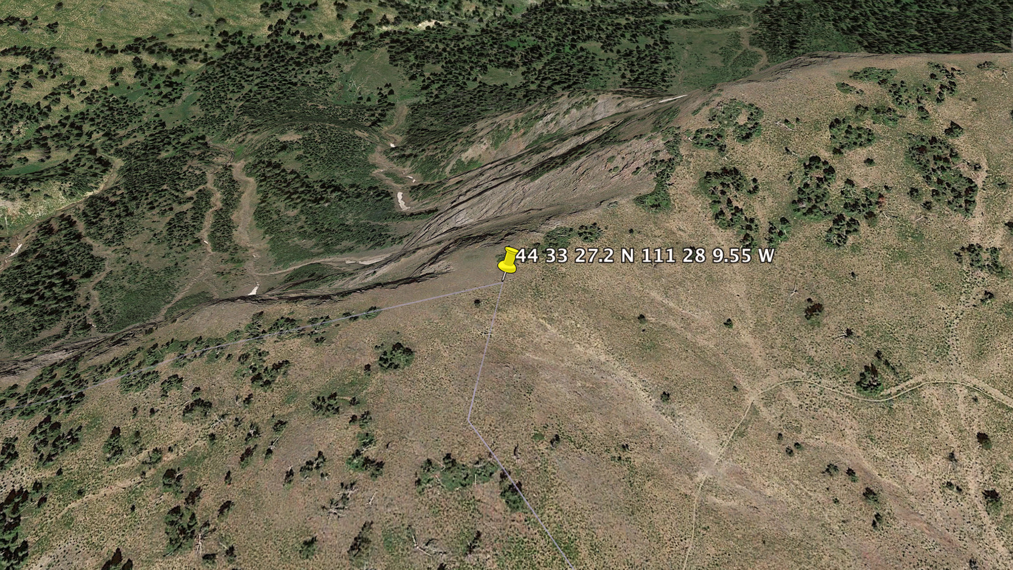
3. SOURCE OF THE MISSOURI RIVER
The true source of the Missouri river is in the Rocky Mountains, on the
U.S. Continental Divide,
at
44° 33' 27.2" N and
111° 28' 9.55" W, at an elevation of 2,864 m (9,396 ft) (Fig. 5).
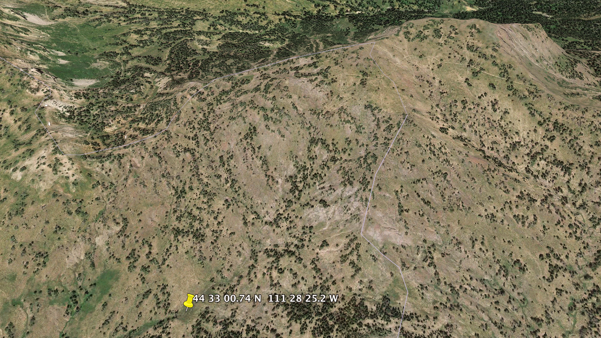
By comparison, Brower's Spring is at
44° 33' 0.74" N and
111° 28' 25.2" W,
at an elevation of 2,684 m (8,806 ft) (Fig. 6).
Table 6 shows the geographical data for the two points.
Table 1 Geographical data of true source and Brower's Spring.
|
| Point |
Elevation
(m) |
Latitude |
Longitude |
| True source |
2,864 |
44° 33' 27.2" N |
111° 28' 9.55" W |
| Brower's Spring |
2,684 |
44° 33' 0.74" N |
111° 28' 25.2" W |
|
[Click on top of image to display]
Fig. 5 Panoramic view of the true geographical source of the Missouri river.
[Click on top of image to display]
Fig. 6 Panoramic view of the location of Brower's Spring.
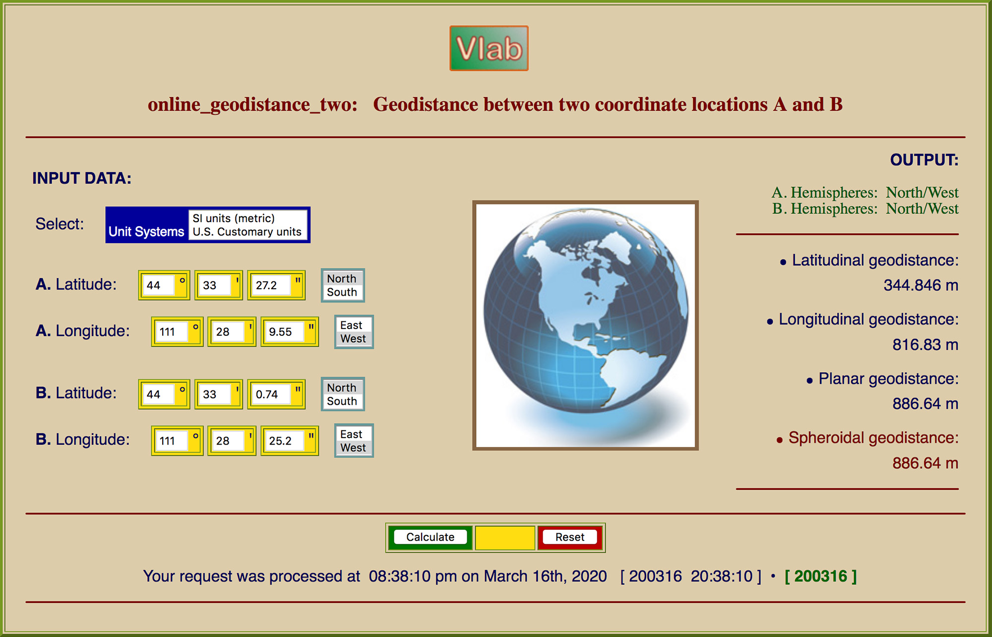
The distance between the two points may be calculated using
the online calculator online_geodistance_two.
The result shows that the distance
is 886.64 m (2,908.9 ft) (Fig. 7).
[Click on top of image to display]
Fig. 7 Distance between Brower's Spring and
the true geographical source of the Missouri
river.
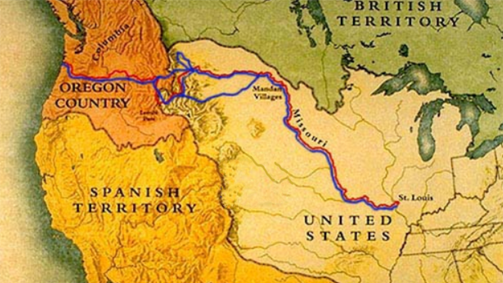
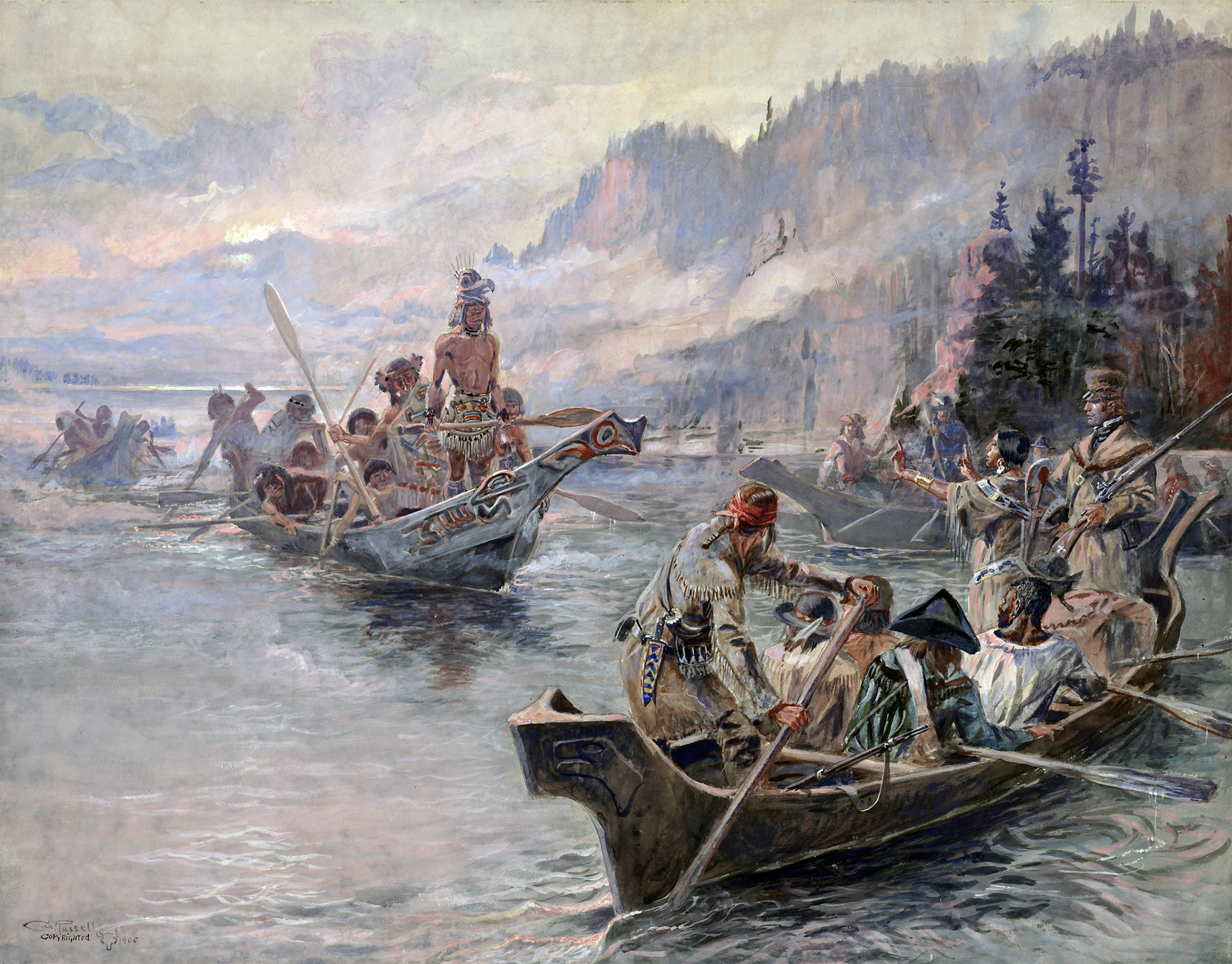
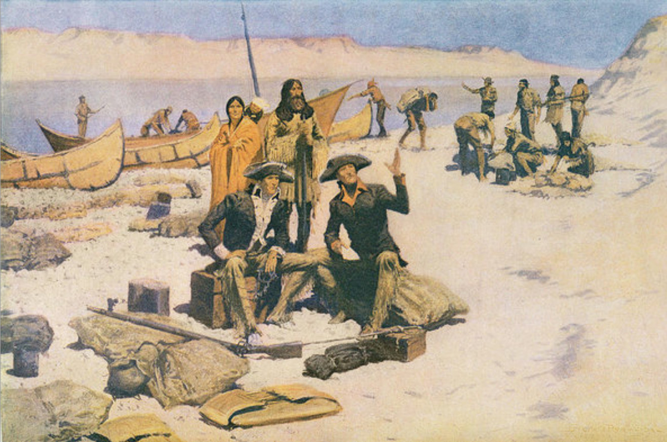
4. LEWIS AND CLARK EXPEDITION
The Lewis and Clark Expedition, which took place
between May 1804 and September 1806,
was the first official American expedition to cross the western
portion of the United States.
It began in Pittsburgh, Pennsylvania, making its way westward to
eventually reach
the Pacific Ocean. The expedition was composed of a volunteer group
of U.S. Army soldiers under the command of Captain Meriwether
Lewis and his close associate Second Lieutenant William Clark.
| Abridged from ushistory.org |
Fig. 8 Route of the Lewis and Clark expedition (red outbound; blue inbound).
The river portion of the expedition departed from Camp Dubois, Illinois, near
the present-day Wood river,
on May 14, 1804,
ascended
the Missouri river and
came close to its source in Montana, proceeding
instead
to the Pacific Ocean. On August 12, 1805, they
crossed the U.S. Continental Divide at Lemhi Pass and reached the Salmon river.
Finding the latter too risky
to navigate,
they decided instead to portage
onto the neighboring watershed (Fig. 9), descending
the Clearwater river to reach the Snake river and,
eventually, the mouth of the Columbia on November 20, 1805 (Figs. 10 and 11).
[Click on top of image to display]
Fig. 9 Lewis and Clark on the Lower Columbia river.
[Click on top of image to display]
| Charles Marion Russell (Humanities Texas) |
Fig. 10 Lewis and Clark on the Lower Columbia river.
[Click on top of image to display]
|
Frederic Remington (fineartamerica.com) |
Fig. 11 Lewis and Clark at the mouth of the Columbia river.
|